Shaver’s Creek is undeniably a community of bird lovers. Tales of unique birds and first of the year sightings spread among staff, volunteers, and visitors like wildfire. Because we are birders it is important for us to support the conservation of these animals. As environmental educators, we try to do that in a variety of ways. Along with spreading awareness through our educational programs we have also been contributing to many different citizen science projects. The most popular is eBird, an online checklist where birders can input information about the birds that they have seen in the field. Shaver’s Creek is also involved in other citizen science projects that relate to birds including Project FeederWatch, HawkWatch, and Habitat Network.
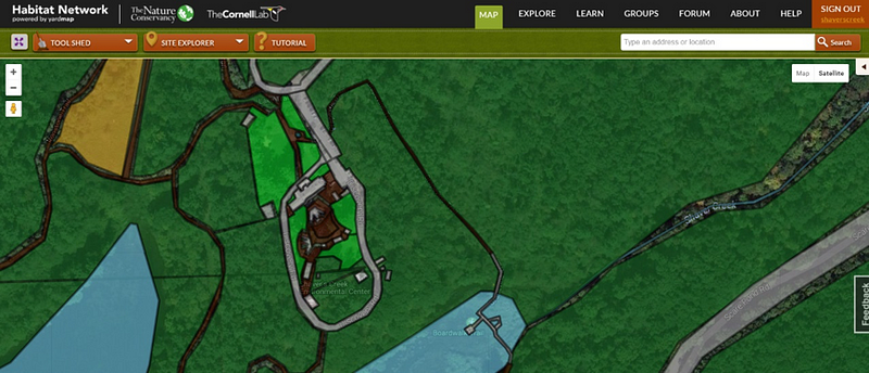
As an intern here at Shaver’s Creek I was lucky to get the opportunity to work on our Habitat Network map for the center and the surrounding Stone Valley Recreation Area. Habitat Network, or Yard Map, is an online mapping software run by the Cornell Lab of Ornithology. It is to plant lovers and gardeners what eBird is to birders. Users can create a map of their yard, explore articles and resources related to habitat management, and even have the opportunity to peek into other users yards by looking at completed maps. Cornell’s goal in facilitating this massive citizen science project is to gain a richer understanding of wildlife habitat and to spread awareness about the ecological importance of native plants.
Starting your own Habitat Network map is as easy as making a free account. The system is connected to Google Earth so you can see a satellite picture of your property. In order to classify the different land cover types in your yard all you need to do is look at the picture and draw shapes with your cursor. A former intern, Maggie Ruppel, put in hours of work to classify almost the entire area surrounding Lake Perez as either buildings, lawn, trails, or forest. Once this part is done, the real fun begins! Habitat Network allows users to plot out individual plants, their locations, whether they are annual or perennial, and what type of food source they provide to birds. When planning a small garden this can be an extremely useful tool. However, when faced with all 7,000 acres associated with Shaver’s Creek, it was a daunting task.

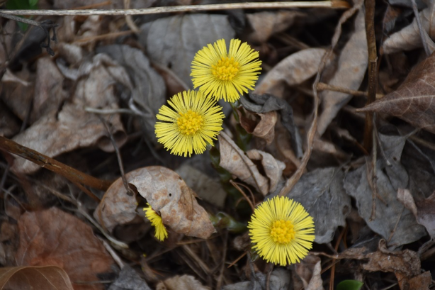
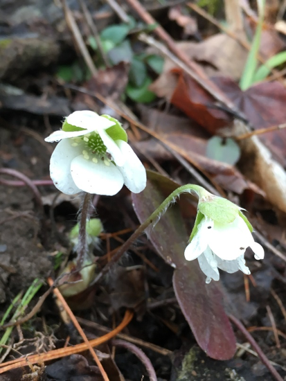
I decided to start small by recording wildflowers. This information could be useful not only to the researchers at Cornell but also to Shaver’s Creek visitors and staff looking to find and enjoy some early spring flowers. Habitat Network allows you to upload pictures of any plant that you record. This gave me some extra motivation to get out on the trails and find some new species.

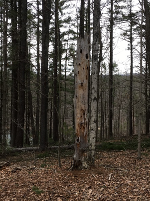
I also worked to find snags, or standing dead trees, along our trails. These trees provide essential habitat and food for countless species of birds, especially woodpeckers who love to make holes in the wood in search of insects.

Habitat Network allows users to set goals for each site that they map. These goals could be anything from managing water to supporting birds to empowering your community. When you decide on a goal the website will give you specific ideas for steps you can take towards achieving it. Choosing the goal of supporting birds gives suggestions such as leaving leaf litter on site, as this is a vital habitat for insects. Other suggestions include building a nestbox and planting a native tree or shrub. As you complete each of these ideas and make additions to your map you can watch as you get closer and closer to your goal. The amount of information available through this website is incredible. Whether you are looking for tips on how to support wildlife in your garden, want to make connections to other gardeners in your area, or simply want to contribute to an important citizen science project, Habitat Network is for you.
Why is this information useful to scientists? Because it is used in conjunction with the hundreds of bird-sighting observations that are entered into eBird every day, Habitat Network helps to paint a picture of the intricate relationship between birds and their habitat. Understanding how the composition of plants and other habitat features in an area can impact the lives of various birds is an important step towards the conservation of these animals.

And so, the never-ending project continues. My hope is that as new interns join the Shaver’s Creek team, new ideas and creativity can be added to this map. Just like the ecosystem it represents, it will always be changing and evolving. The balance between birds and the environment in which they live is delicate. Tools like Habitat Network can provide us with a deeper understanding and appreciation for the complex interrelationships that make up our ecosystem.
Check it out! http://content.yardmap.org/
